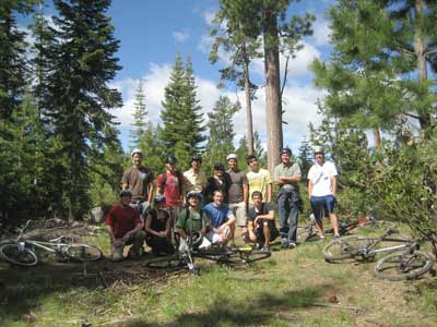
Trail Overview
Bend, Oregon is located just east of the Three Sisters mountains and Mount Bachelor, providing outdoor enthusiasts with plenty of trails to explore in the national forests. Although a lot of the information below is more directed to mountain bikers, several of the sites (like the US Forest Service) have trail information for hiking and other activities as well. As far as mountain biking is concerned, the following two areas are where most people will want to start looking for trail info:- Phil's Trail Network - There is a specific trail called Phil's trail, but it is only one trail among many in the entire network of connected trails in the area. There are literally hundreds of miles of trails to be explored. It would be easy to get lost amongst all the trails if you aren't properly prepared with trail info.
- Deschutes River Trail - A great trail that follows a portion of the Deschutes river and provides several views of falls.
One last thing...keep the following things in mind when planning a mountain biking ride near Bend:
- Some (but not all) of the trail heads and parking areas near Bend require a day pass / parking fee from the US Forest Service. The US Forest Service map linked to below shows which trail heads require a pass and which ones don't.
- Some of the trails in the higher elevations are still inaccessible in early summer due to snow levels. Local bike stores (like Pine Mountain Sports), US Forest Service, and others can give current conditions if you need them.
- The Flagline trail (which can be seen on the US Forest Service map) is only open after August 15 due to elk migration.
- The North Fork Trail is for uphill riding only...no downhill. This is one of the few trails where you are forced to go one direction.
Bend Map and Trail Resources
Of all the resources below, I found that the GPS/Google Earth data from Oregon Mountain Biking (ormtb.com) was the most useful for getting familiar with the trail names and locations. Google Earth is an invaluable tool for visualizing trail locations and planning a route. It is also great to be able to load the data on your own GPS so you can have it with you during your ride (in addition to a paper map of course). |
| Screenshot of Google Earth displaying almost all the mountain biking trails in Bend, Oregon. See information below for downloading the Google Earth KMZ file with this data. |
Oregon Mountain Biking (ormtb.com)

- Bend and Central Oregon Trail Information - ORMTB's main page for Bend and Central Oregon trails.
- Central Oregon Overview Map - An overview of areas around/near Bend that have mountain biking trails.
- Phils trails 8.5 x 11 Pocket Map - This is a link to a PDF document that has a nice map of Phil's area. This is the first of 3 maps I found really useful.
- Google Earth KMZ File - This was the most valuable resource for me. This is a link to the Google Earth KMZ file that has trail info for most of the main trails near Bend. In Google Earth, you can gather and view all sorts of information (elevation profiles for routes, measure route distances, etc)...great for planning.
US Forest Service - Deschutes National Forest

- Central Oregon National Forest Home Page
- Online Maps of Central Oregon - This page links to the following two resources...
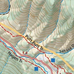
- Tumalo Trail System Map (includes Phil's area) - This is a link to a PDF file containing a map. This is the second of 3 maps I found really useful.
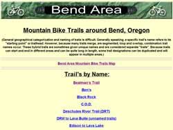
- Individual Trails and Maps - This is a list of trails near Bend with information on distances, trail conditions, type of trail (bike, hike, horse, etc) and with trail maps for many of the individual trails.
Adventure Maps
Areas Included On the Map
"The Bend, Central Oregon Mountain Biking and X/C Skiing Adventure Map is a waterproof, topographic map that includes a route guide covering trails throughout Bend, Sisters, and all of Central Oregon. This map provides full beta for mountain biking trails in the Phil's Trail System in Bend and the Peterson Ridge System in Sisters.
It also includes detailed map and route descriptions for hiking, nordic skiing and trail running trails throughout the Central Oregon Cascades, Sunriver, Sisters, Newberry Crater & Horse Ridge, Gray Butte & Smith Rock, Waldo & Cultus Lakes and the McKenzie River Trail." -Adventure Maps
Waterproof and Tear Resistant, Revised at 3-year Intervals
"We print our maps on Polyart or HopSyn which, as plastics, are waterproof and tear resistant. Our goal is to revise and re-print each of our maps at 3 year or less intervals. This allows us to keep our maps very up-to-date with the latest trail changes and graphic enhancements." -Adventure Maps
Size of the Map
- Map Open Dimensions: 27 X 39 inches
- Map Folded Dimensions: 4 X 9.75 inches
- Map Scale: 1:44,000 & 1:63,360
Donald Wyman's Trail Information
Central Oregon Trail Alliance (COTA)

- Skidding causes erosion
- Keep single track single
- Be courteous as some of the more popular trails can be croweded with runners, hikers, families, racers, recreational cyclists, etc
VisitBend.com
This site was created and funded by the Bend City Council. I didn't use this for any of my planning, but it does look like they have some good trail information. It looks like a good site in general if you are going to visit Bend; they have information on skiing, snowboarding, golfing, fishing, hiking, biking, rafting, and other activities.Please leave a comment if I've missed a valuable resource that you think I should add to the list.

No comments:
Post a Comment